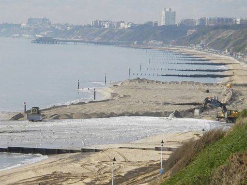
Pumping ashore beach material delivered by the offshore dredger (Bournemouth, 2008)
Durlston to Hurst Sediment Resource Management Programme
A new approach to secure a local and sustainable sediment resource for future beach renourishment schemes in Poole Bay, Christchurch Bay & Swanage.
BCP Council has applied to The Crown Estate for a 20-year seabed licence to access local sediment which would be exclusively used to renourish beaches in Poole Bay, Christchurch Bay & Swanage. We are calling this the Durlston to Hurst sediment resource management programme.
The purpose is to defend the shoreline from coastal erosion whilst reducing our reliance on commercial aggregate dredge sites. It is getting harder to source the appropriate materials for our beaches because of dwindling supplies and increasing costs. Managing our own seabed licence, would allow us to:
- Significantly reduce the cost of beach renourishments by coordinating works across the region and sharing equipment and mobilisation costs.
- Access a high-quality sediment resource for coastal defence purposes. The material originates from our local beaches and will be retained in the system for future reuse, without introducing new sediments from dredge sites not local to our region.
- Opportunities to increase operational efficiencies (e.g. by introducing smaller more frequent top-ups).
- Improve sustainability in terms of carbon (and other emissions) emissions by avoiding long-haul shipping and/or transportation of materials by road and reducing overall project durations.
- Increase our coastal resilience by being able to be more responsive to emergency renourishments (if required) following large storm and erosion events like those experienced after the Winter 2014 storms.
- Provide additional benefits to the local community in terms of tourism and the amenity value of ‘blue’ spaces.
If our proposal is successful this arrangement (where a Coast Protection Authority has access to a non-profit sediment resource) will be unique. It will enable us to implement our beach management objectives, set out in the Shoreline Management Plan. Potential dredge operations in a location known Area 2105 will be delivered under best practice procedures in accordance with the requirements of The Crown Estate (the seabed owner) and the Marine Management Organisation (government regulator). This includes tracking and recording of all vessel movements, and comprehensive health and safety checks. The area will be monitored over the licence duration and it is expected that because we are dredging mobile sediments (understood to originate from the beaches) we can evidence the rapid recovery of these areas.
The Marine Licence Application will be available for public consultation via the MMO website – gov.uk/government/organisations/marine-management-organisation.

The Durlston to Hurst sediment resource management programme would make use of sediment that circulates within the bays and is retained on the offshore sandbank system made up of Dolphin Sands, Dolphin Bank and the Shingles Bank.
The need for a cost-effective supply of beach material
In the last 50 years, over 10 million tonnes of sand and shingle have been sourced for the beaches between Swanage and Hurst Spit to replace what the waves and tides naturally wash away. However, during the last beach renourishment in 2021, when most of the sand and beach material was sourced from a licensed dredge site in the Thames Estuary region, the critical need for a more cost-effective and sustainable beach material resource became clear [about the 2021 beach renourishment].
Most of our local coastal defences have been inherited from the early development of our towns. Seawalls were constructed to reduce cliff erosion where the falls had provided a natural sediment supply to the beaches. Once seawalls were in place to minimise cliff erosion, the movement of beach material accelerated. Groynes were then constructed to retain the beach material and reduce the losses, but this natural process of longshore drift could not be stopped. Since the 1970s the beaches have been periodically renourished, or topped-up, with imported material to reduce the risk of flooding and coastal erosion to properties and infrastructure. If we were to do nothing, the beaches, cliffs and thousands of homes would be lost to the sea.
‘Holding the Line’ with beach renourishments
The Shoreline Management Plan (SMP) developed the policies to manage the risk of coastal erosion through a mostly ‘Hold the Line’ approach over the next 100 years. This requires coastal defences to be maintained and upgraded or replaced in their current position where funding permits. The SMP ‘Hold the Line’ approach is currently achieved using a combination of beach renourishment and groynes in Poole Bay.
During the last beach renourishment in 2021, BCP Council imported over half a million tonnes of sand from the North Sea to deliver its current 5-yearly programme of beach renourishment in Poole Bay. Additionally, at Milford-on-Sea to Hurst Spit, chronic sediment starvation and the resultant erosion mean that emergency works are undertaken involving the importing of sand, gravel and rock by road and sea. In the face of sea level rise and the climate emergency, this is a serious concern and does not offer a long-term solution (whereas a long-term supply of sediment from Area 2105 to top up beaches would better manage this).
Where does our beach material go?
Modelling, surveys and sampling indicates that the coast and sea between Durlston to Hurst behaves as a ‘single sediment system’. It is known as SMP sub-cell 5F. Most of the material lost from the beaches via longshore drift accumulates on vast underwater sandbanks within this sediment system. By working with natural processes, this material can be recycled to our beaches, rather than importing more expensive material from further afield.
Sediment transport (longshore drift) in Poole & Christchurch Bays

Source: SCOPAC Sediment Transport Study 2012, Poole Harbour Entrance to Hengistbury Head. Available at www.scopac.org.uk/sts/poole-bay.html

Source: SCOPAC Sediment Transport Study 2012, Hengistbury Head to Hurst Spit. Available at www.scopac.org.uk/sts/christchurch-bay.html
Next steps
The next planned beach renourishment scheme in Poole and Bournemouth is due to take place in 2027/28. The aim is to use this local sediment resource to provide significant cost saving to taxpayers. Into the future, beach renourishment may not be a sustainable or viable option owing to increasing costs, limited availability of suitable beach material and challenges over the transportation of materials over longer distances. Coupled with sea level rise and an increase in the severity and frequency of storms, more permanent hard engineered solutions may be required to fulfil the ‘Hold the Line’ policy to defend the coastline from further erosion. These options may also face serious sustainability challenges.
The seabed licence for the Durlston to Hurst sediment resource management programme to reuse and recycle the beach material provides the best sustainable solution to retain our beaches in their current condition for as long as possible.
ABOUT OUR LOCAL SEDIMENT RESOURCE
- Sediment circulates within Poole Bay and Christchurch Bay and is retained on the sandbank system made up of Dolphin Sands, Dolphin Bank and the Shingles Bank.
- The banks have a combined volume in the range of 180 million to 360 million m³. By comparison, Chesil Beach in Dorset is estimated to be between 15 and 60 million m³.
- If beach renourishment continues approximately once every 5 years, it will result in less than 0.3% of the total volume of the banks system being dredged.
- Less than 30cm depth of sediment would be removed in the permitted areas so the lowering of the banks would have a minor, temporary impact with expected rapid recovery as evidenced from bathymetry data, sediment transport studies, and modelling.
- A detailed Environmental Statement was produced for this work and is available in the MMO consultation. It includes detail on survey and data sets used for Environmental Impact Assessment (EIA) and we have also commissioned a high-resolution side-scan sonar and magnetometer survey and services of a professional archaeologist to determine historical/archaeological assess any residual risks prior to any dredging.
- The National Network of Regional Coastal Monitoring Programmes (formerly Channel Coastal Observatory) provides a huge data set that is widely used to understand the coast and evidence the impacts of dredging this area in the past, for example Hurst Spit in 1997 and Bournemouth in 1974/5.
Beach Management timeline

For further reference on this website
- Poole Bay & Harbour Strategy 2014 (pdf)
- Poole Bay Beach Management Scheme
- Christchurch Bay & Harbour Strategy 2025
Other sources of information
- Knappen, M. (2019) Sediment modelling for Poole and Christchurch Bay | EPrints at HR Wallingford
- Coastal sediment budget project: Offshore sediment transport pathways in Poole and Christchurch Bays 2013-2016 | The Southern Coastal Group and SCOPAC
- Vegetated Shingle Study, Hurst Spit 2017-2018 | The Southern Coastal Group and SCOPAC
- SCOPAC Sediment Transport Study 2012 | SCOPAC
Poole Bay Beach Renourishment projects since 2005